The core objective of the EXDIMUM project (Extremwettermanagement mit digitalen Multiskalen-Methoden), is to tackle the complexities of extreme water management within the context of complex challenges. This stems from the acknowledgment that global climate change not only results in changes to average precipitation levels but also leads to a heightened intensity of extreme events, including droughts and local heavy rainfall.
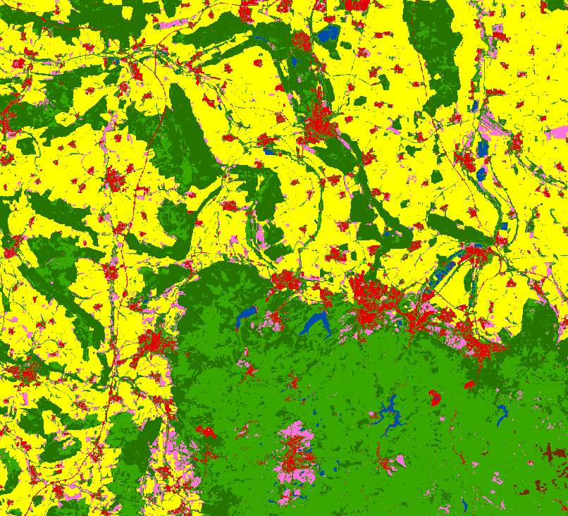
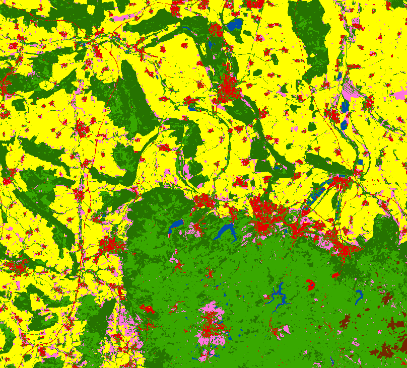
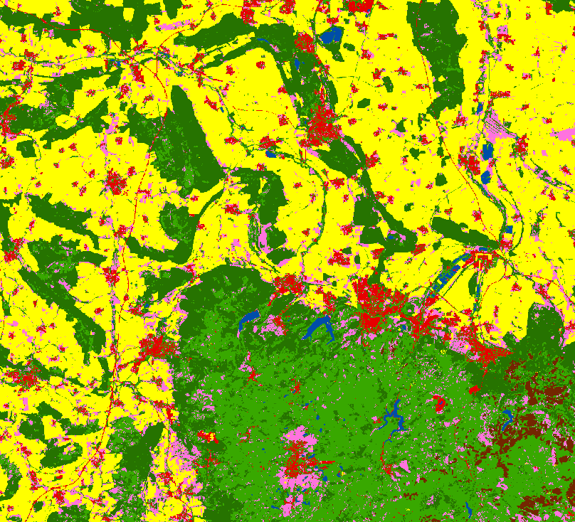
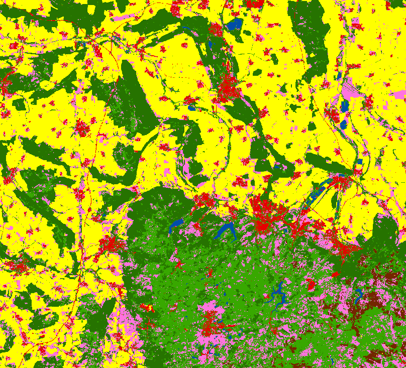
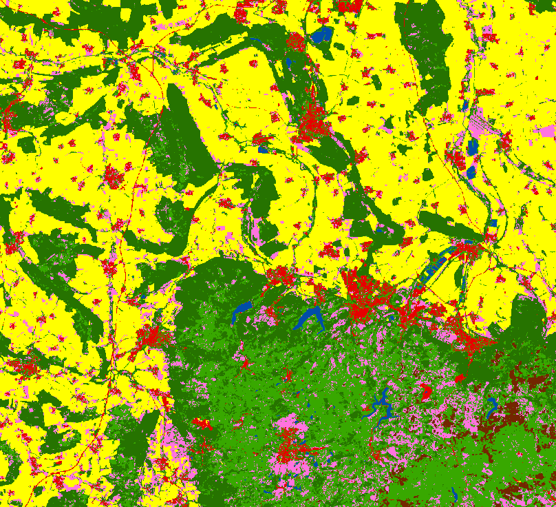
The IGP plays a significant role in this project by providing waterbody detection and land cover mapping over the years of 2018-2023. To this end, we apply a time series of satellite data with different temporal and spatial resolutions and advanced deep learning techniques. These products can be also considered as input for the Hydrological model.
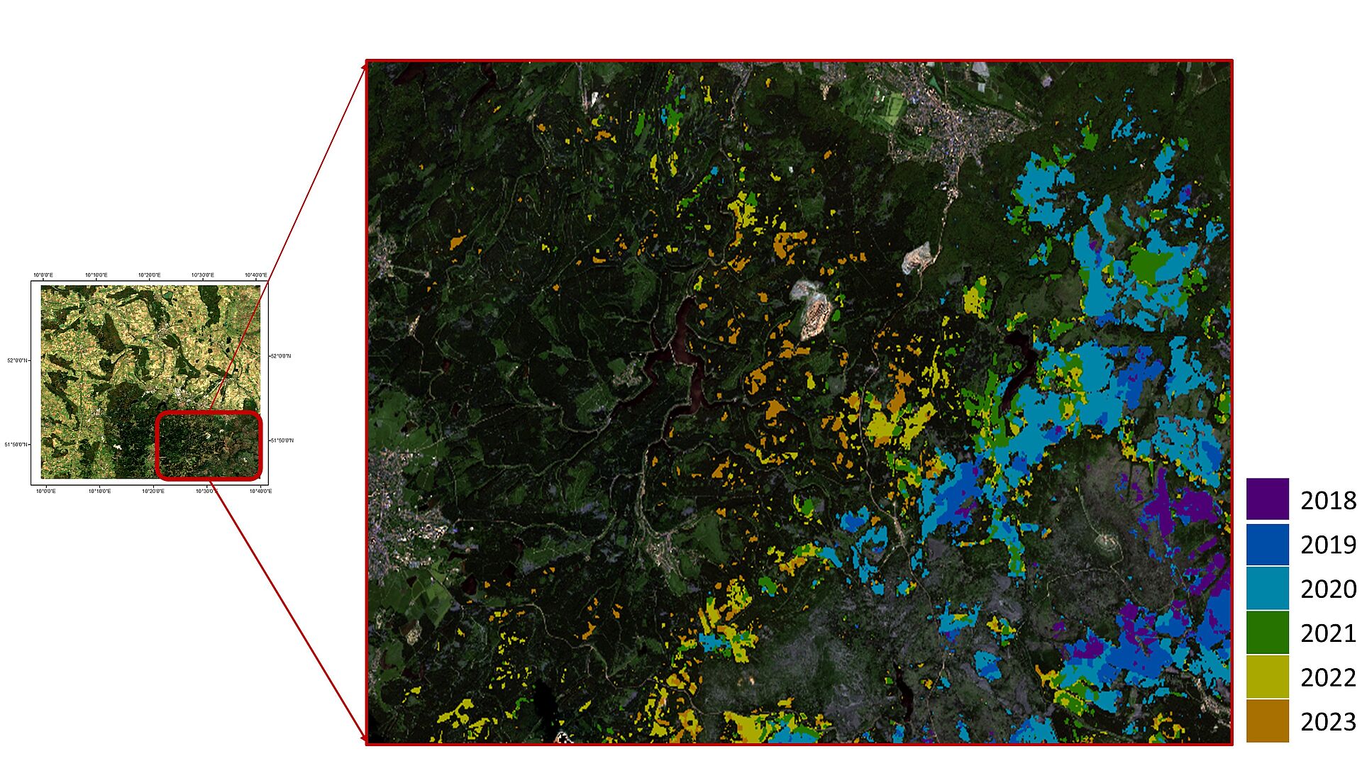
Furthermore, a change analysis of the classification maps from 2018 to 2023 was performed and it revealed a clear increasing trend in the number of dead trees over the years.


| Project: | EXDIMUM (Extremwettermanagement mit digitalen Multiskalen-Methoden) |
| Duration: | 01.02.2022 – 31.01.2025 |
| Cooperation partner: | TU BS - Institut für Betriebssysteme und Rechnerverbund - Abteilung Algorithmik |
| Clausthal University of Technology | |
| University of Kiel | |
| DSI Aerospace Technologie GmbH | |
| REMONDIS Aqua Industrie GmbH & Co. KG | |
| Ameno GmbH | |
| EURAWASSER Betriebsführungsgesellschaft mbH | |
| Funding institution: | BMBF |
| Contact: | Fatemeh Saba, Aida Taghavi |