The importance of the tidal Elbe as an important transport route is maintained by various river engineering measures such as the construction and operation of groynes in the centre of the river. The groynes increase the flow velocity in the centre of the river and reduce it in the bank zone. As a result, fine-grained and silty sediments transported by the tide and loosened by erosion processes in the navigation channel can be deposited in the groyne fields. As a result, biologically valuable shallow water zones are lost due to siltation.
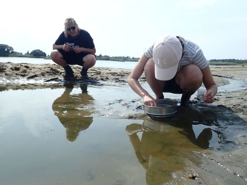
In a pilot project, the Elbe Habitat Foundation is attempting to counteract this process by notching individual groynes, changing the flow conditions in the groyne fields and removing sediments again. The aim is to create new, important aquatic habitats in this way. The impact of the measure, which will be implemented in January 2023, will be recorded by monitoring various sub-areas over a period of four years. On behalf of the foundation, we have been documenting the changes since 2022 in the sub-areas of vegetation, macrozoobenthos, bank sediments and bank morphology.
The TUBS team included:
Institute of Geoecology, Working Group Landscape Ecology: Christine Schottmüller, Natascha Holl, Dr. Michael Strohbach
Leichtweiß-Institut für Wasserbau: Dr. Gabriel David
Link to the video of the Elbe Habitat Foundation describing the measure

